Kingdom Trails (Burke)


Ramble Reviews
Average: 4.91 (of 183)

One-of-a-kind Gift

Gorgeous View of MRV
Kingdom Trails (Burke)
Choose A Material
Learn MoreChoose A Size
Height x WidthWhen we create a Ramble map, our goal is to show the beauty of the landscape as best we can. We want you to see the hills, valleys, rivers, and transitions between ecosystems. Each map shows something unique. Each area has something surprising, even to those who know it well.
About This Map
This map is a 2-dimensional print that is ready to hang right out of the box on a backing that will float it off the wall, giving it a nice shadow like in our pictures.
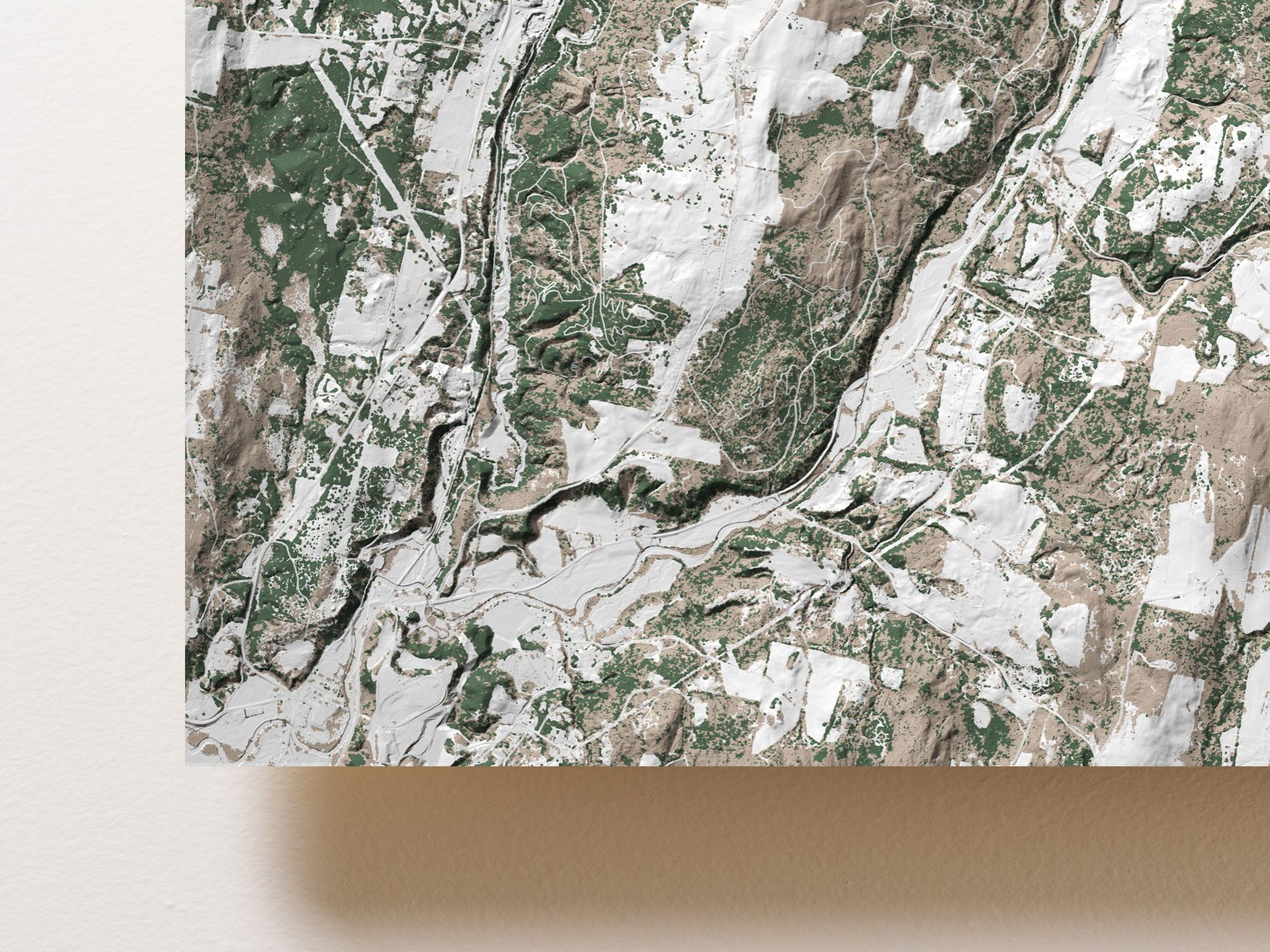
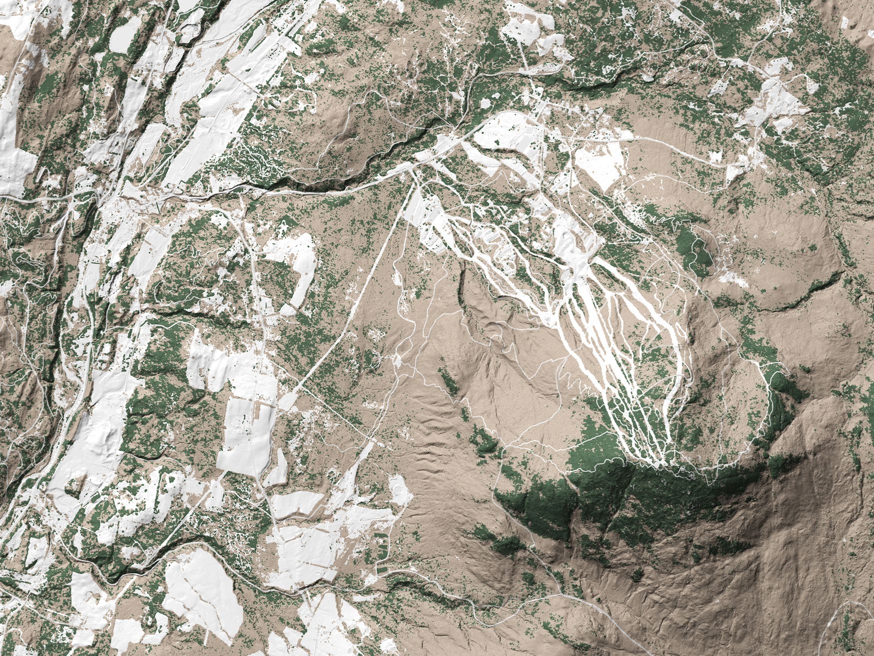
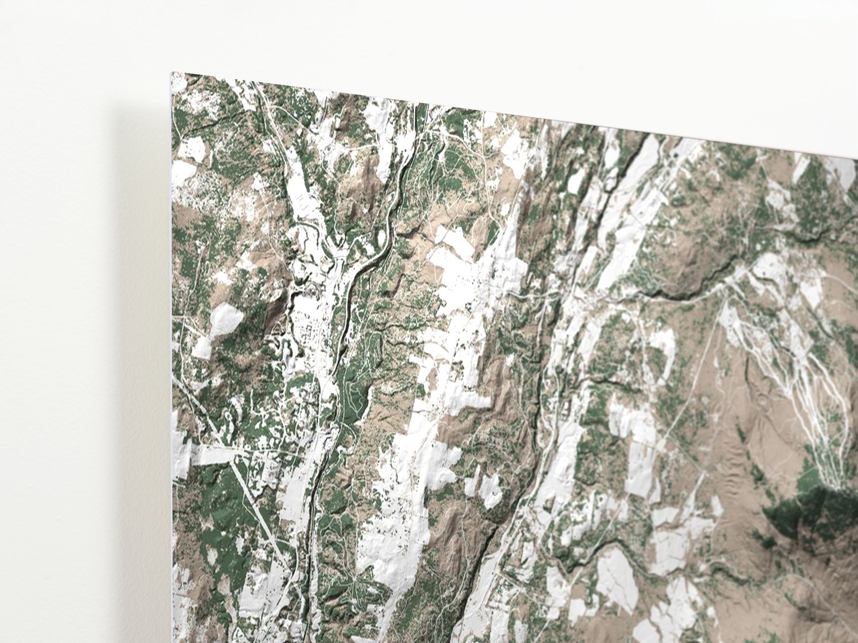
In the summer, the Kingdom Trails are home to some of the best mountain biking in the northeast. In the winter, those same trails are traveled by nordic and backcountry skiers.
Our map shows all of the terrain loved by so many, from Darling Hill to Burke Mountain and the wild terrain beyond.
Estimated Arrival
Each map is made to order in the USA and will arrive in 1 to 3 weeks.
Ramble Reviews
One-of-a-kind Gift

Gorgeous View of MRV

Choosing A Material
Face Mounted Acrylic
This option maximizes contrast and detail, resulting in a stunning image that catches the light as you move around it.
The map is printed on metallic photographic paper and then 1/4" of acrylic glass is mounted to the front of it. It is our highest quality option.

Wood Mounted
The wood mounted map has a rustic, understated, and classy feel to it.
This option looks great in the widest range of lighting setups. It feels the most natural and physical of all of the options. The wood mounted map has a matte finish, so it reflects less light than the other options.

Aluminum
The aluminum map looks sleek, smooth, and modern. It has a high-gloss surface, which gives it deep colors, high contrast, and vibrancy. Under good lighting, this map is truly eye-catching.
This option is light weight and has a lower price than acrylic, at a slightly lower resolution.


